 Berkhamstead common


The southern part of the Icknield Way Trail passes through the Chilterns Area of Outstanding Natural Beauty. Passing through Ashridge and on into Whipsnade passes through some impressive woodland.
Route
The Icknield Way riders route diverges a reasonable distance from the walkers route to Ivinghoe Beacon. Unfortunately there are simply no suitable bridleway or quite roads in the area. So the route takes a southerly diversion into the Ashridge Estate and past the Bridgewater Monument which was built in 1832 in memory of the third Duke of Bridgewater who once lived in Ashridge house. It is possible to climb to the top where you will be rewarded with beautiful views of Ashridge from above.


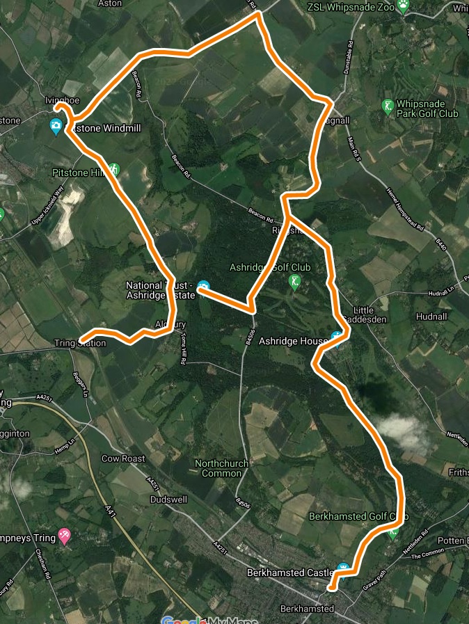
The Icknield Way Trail riders route follows the route shown in pink. This largely uses a route open to vehicular traffic. The route in blue would be more direct and keeps ‘off road’. Blue route is bridleway between the roads, but near Ashridge college it is a permissive bridleway which does not allow cycles. The Icknield Way Trail is a multi-user route suitable for walkers, horse riders and off road cyclists. Horse riders may wish to use the permissive bridleway shown in blue. In May 2012 National Trust turned down a request to upgrade the permissive bridleway to include cyclists. The ‘blue’ route is not waymarked. The longer route through Nettleden has an impressive cutting which is well worth the longer route on a bike.
Horse riding on the Ashridge Estate, other than on public bridleways, is controlled using a permit scheme. Details are available from the National Trust – Horse riding at Ashridge.
The route in West Hertfordshire re signed at the roadside and the waymarking improved during 2012.
GeoConservationUK – on-road cycle route
This is an on-road cycle route to explore the geology of Berkhampstead, Ashridge, Dagnall, Pitstone and Tring. The route can be a circular route using a a short rail trip between Tring and Berkhamstead stations Link
Thanks to Tom Hose for preparing the descriptive leaflet and route map.