The Google route map has layers for the off-road biking, equestrian and walking routes, each can be turned on or off. It also has layers for faculties along the route such as refreshments, camping and transport links.
The Icknield Way is a OS Maps Trusted Route Partner and has mapped sections of the route. The OS map allows to view the route against a Landranger or Explorer map backgrounds (with registration and/or subscription). Route maps can be taken off-line and GPX files downloaded.
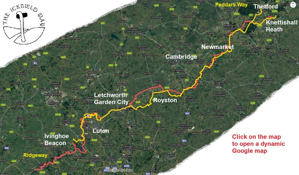
The menu links give further information about the route county by county. The walkers, off-road cycle and equestrian routes follow slightly different routes at places.
Riders Route – off-road cycle – OS map links
| Ridgeway – Chinnor to Pitstone | 38.87km | OS Map |
| Pitstone to Chilterns Gateway Centre | 22.07km | OS Map |
| Chiltern Gateway Centre to Streatley | 26.78km | OS Map |
| Streatley to Letchworth | 18.47km | OS Map |
| Letchworth to Melbourn | 24.99km | OS Map |
| Melbourn to Linton | 28.12km | OS Map |
| Linton to Gazeley | 36.91km | OS Map |
| Gazeley to Knettishall Heath | 38.40km | OS Map |
Riders Route
As well as the OS maps the GPX/KML files can also be downloaded from the mountain biking route and equestrian route from the links on the right.
The riders route was first documented by Elizabeth Barrett in her 1993 book “The Icknield Way path, a guide for horse riders, cyclists and others”. ISBN 09516011 2 1. The route has changed since 1993 but it includes some interesting text. The out of print book is available from libraries.
Walkers Route
The Icknield Way Walkers route has it own website: www.IcknieldWayPath.co.uk.
The Icknield Way Path Guide contains detailed walkers route descriptions and clear maps, supplemented with notes on the geology, geomorphology, archaeology, flora and bird life along the Path, plus backup information on public transport in the area. ISBN 978-0-9521819-3-4. Only available from the Icknield Way path website.
GPX/KML file can be downloaded from this link walkers route and then from the link on the right. The OS maps have a diamond highlighting the walkers route (not the riders route).
The OS maps are a little confused and in places show both the Icknield Way Trail and the Icknield Way Path. We have asked OS to only show the walkers route to avoid confusion.
Accessible sections
Many sections of the Icknield Way are probably accessible to users with mobility issues using mobility scooters through to off-road trampers. The riders routes generally have less structures than the walkers route We currently do not have the skills to access the routes but would welcome any contact who would be able to properly assess and advise on accessibility. We believe these locations are most accessible:
- Chiltern Gateway Centre, Dunstable
- Sundon Hills Country Park, Bedfordshire
- Sharpenhoe Clappers, Bedfordshire
- Warden & Galley Hills, Bedfordshire
- Pirton to Ickleford, Hertfordshire
- Therfield to Royston, Hertfordshire
- Tuddenham to Icklingham, Suffolk
See Phototrials and Disabled Ramblers for more information for the type of information we would like to promote.
Great Chalk Way
The Icknield Way forms part of a family of multi-user routes from Dorset to Norfolk known as the Great Chalk Way.